WE HAVE A DATA-DRIVEN PREVENTIVE STRATEGY
THE PROBLEM
The decline of biodiversity is one of the most urgent problems facing humanity. Biodiversity encompasses the variety and variability of life on earth — all the animals, plants, fungi and microorganisms that work together to make up the different ecosystems that exist. Unfortunately, as we put more and more pressure on the planet, biodiversity is declining at an alarming rate.
To effectively address biodiversity loss, nature conservation efforts must be informed by a deep understanding of what is causing it, along with which strategies are effective for conservation and restoration purposes. In short, we need a better understanding of why and where biodiversity is declining and what the key triggers are.

OVERALL OBJECTIVE
Develop predictive, proactive and preventative capabilities for nature conservation stakeholders by combining theoretic premises from the sciences of ecology and environmental forensics with empirical environmental observations (satellite-based & on-site) into a Proof of Principle that is tested and demonstrated in 4 European areas, covering 6 biogeographical regions.
We propose a model-driven, continuous form of ecosystem monitoring assessing not only numbers of species and state, but also the modelled ecological and anthropogenic processes within an ecosystem and their interactions. We will then be able to find cause-effect relations and improve our monitoring models based on retrofits and simulations to understand changes even better. The models, also called Digital Twins, are thus a means for learning and the creation of context to translate environmental observations (data) into facts and actionable information (intelligence) for site managers and policy makers.

SPECIFIC OBJECTIVES
-
Develop in close collaboration with end-users a Proof of Principle to improve the quality and efficiency of biodiversity monitoring by integrating and harmonising different data sources into easy-to-use, (near) real time, evidence-based actionable information (intelligence) for decision-making. Thus reducing time and cost.
-
Integrate ecology science, forensic intelligence and remote sensing technologies and develop cross-organisation biodiversity monitoring and evaluation routines.
-
Develop 4 digital twins by modelling the area, including wildlife behaviour and human activities.
-
Demonstrate and test the Proof of Principle for its capability to unify irregular data collections that have been collected for disparate purposes, to create unified datasets and insights, and to test its value, usability and replicability in four combinations of biogeographic regions and species: Ancares-Courel (Spain), Maramures Transboundary Area (Romania/Ukraine), Danube Delta (Romania) and Stara Planina Mountain (Bulgaria).
-
Capacity building within the conservation, biodiversity monitoring and law enforcement fields.
-
Develop a Policy Lab to allow different sectors (forestry, agriculture, transport, energy, tourism) to use the data and tool suite to experiment with impact assessment of their decisions on nature and ecosystem services.
-
Include existing initiatives and projects to help developing an integrated European biodiversity monitoring system, notably EUROPABON, the Knowledge Centre for Biodiversity, the BiodivERsA Partnership and the consortia for related projects in Horizon Europe.
PROOF OF PRINCIPLE: FOUR RELATED TOOLS

ECOSYSTEM BASE MAPS
A tool to automatically create ecosystem base maps, including biotic, abiotic, natural and anthropogenic features.
This will significantly increase the quality of such maps, lower the costs of creating them drastically, and make comparisons across ecosystems much easier.

MONITORING ECOSYSTEMS
A tool for automatic monitoring of ecosystems and evaluation of interventions. This will facilitate more continuous and proactive monitoring and alerting, needed to detect and address drivers behind biodiversity decline in an early stage.

DIGITAL TWIN MODELS
The modelled ecological and anthropogenic processes serve as the codified body of knowledge to contextualise and interpret environmental observations.
We will also use them to make data-driven prediction and support scenario simulations, thus building upon the latest state of knowledge to create new knowledge about biodiversity drivers and decline.

SEMANTICS-DRIVEN DATA METHODS AND TOOLS
These are needed to bridge taxonomic differences between data collections and organisations and prepare the various data sources for the three above-mentioned tools. To this end, we will apply the latest graph and semantic AI technologies.
RESULTS
It is well known that technology on its own does not offer the solution, therefore Nature FIRST builds the alignment of:

-
Shared urgency, necessity and will to share data and insights;
-
Bridging methods, best practices, using knowledge from other conservation organisations that operate in the same protected area or field of activity.
-
Developing, testing and implementing new (long-term) approaches that make use of recent technological advances and existing data from multiple origins.
OUR FIRST AREAS OF APPLICATION
-
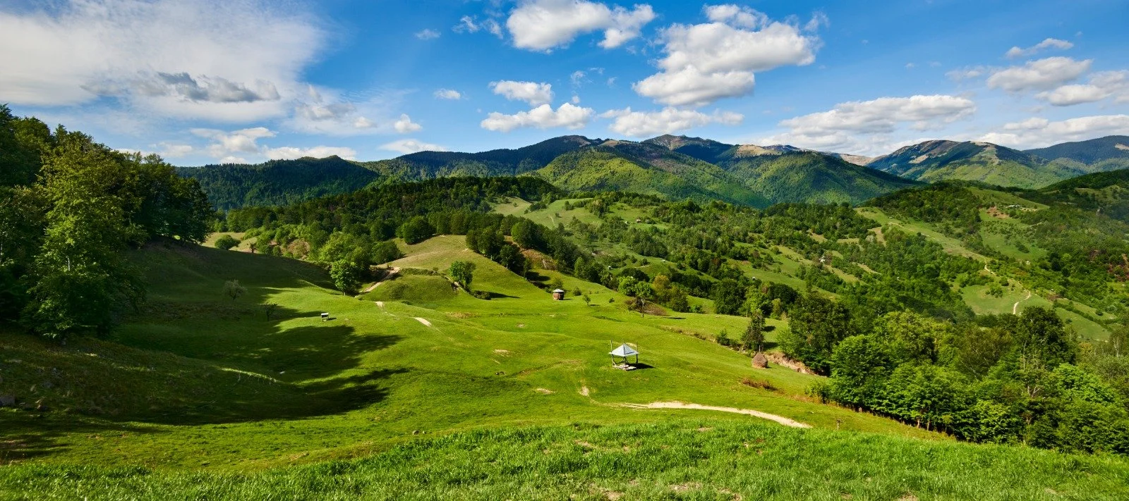
![Scenic mountain landscape with green hills and blue sky]()
MARAMURES TRANSBOUNDARY AREA
Continental/Alpine regions - Romania and Ukraine
This field site is located in the Carpathian Mountains, the last region in Europe to support populations of large carnivores such as brown bears, wolves, lynxes and jackals. The main challenges are illegal logging, poaching, infrastructure development.
Credit image: flickr Mihai Lucîț
-
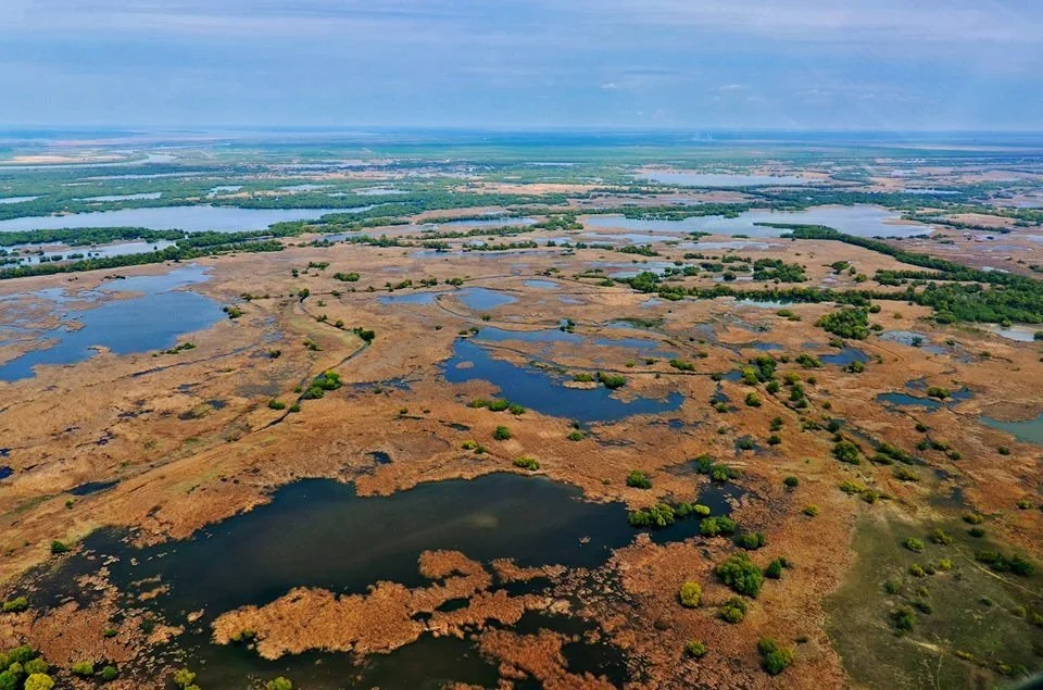
![Aerial view of a vast marsh landscape with scattered ponds, vegetation, and blue skies in the background.]()
DANUBE DELTA
Steppic and Black Sea regions - Romania
A Natura 2000 site that has original natural features. This field site contains unique river and wetland resources. It is also the habitat and migration corridor for the endangered colonial birds and sturgeon species. The main challenges are poaching, unsustainable tourism.
Credit image: Maria Krommyda (distributed via imaggeo.egu.eu)
-
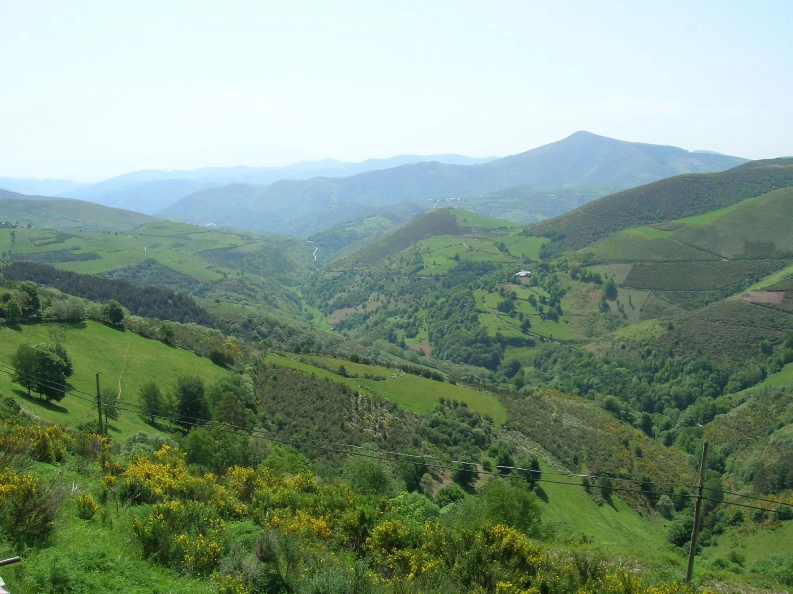
![A scenic view of green hills and valleys with scattered trees and a mountain in the background under a clear sky.]()
ANCARES-COUREL
Atlantic/Mediterranean biogeographic regions - Spain
A Natura 2000 site in Northwest Spain, Galicia. This field site has high biodiversity and is inhabited by 150 endangered species. The main challenges are abandonment of farmland, intensification of agriculture, human-wildlife conflicts.
Credit Image: Flickr José Antonio Gil Martínez
-
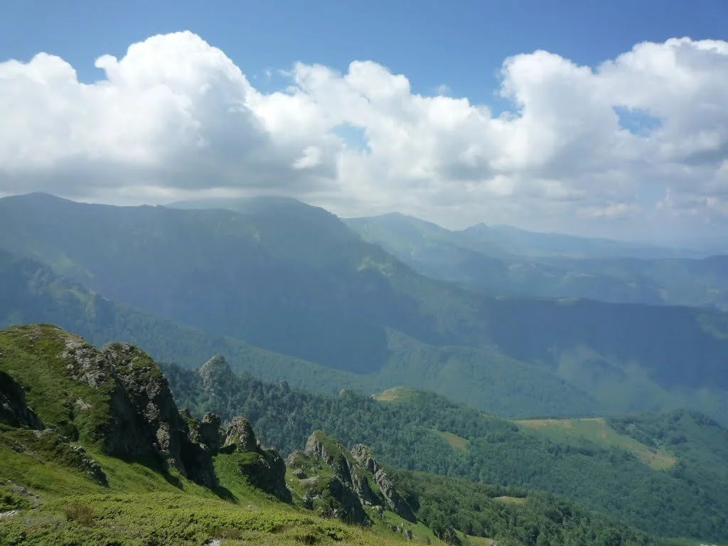
![Mountainous landscape with green valleys and rocky peaks under a partly cloudy sky.]()
STARA PLANINA MOUNTAIN
Alpine/Continental regions - Bulgaria
A part of the Central Balkan National Park. This field site falls into three climate zones at the same time. It is inhabited by 80 protected species.
The main challenges are intensification of agriculture, human-wildlife conflicts, poaching.
Credit image: Красимир Косев