TECH SOLUTIONS
The urgency of addressing the decline in biodiversity requires innovative and proactive approaches, and a data-driven preventive strategy is crucial to the success of nature conservation efforts. Technology plays a pivotal role in achieving this goal, providing a suite of tools and methodologies to enhance our understanding of biodiversity loss, predict potential threats, and formulate effective conservation strategies. Nature FIRST offers a variety of tech solutions and tools developed to address the specific issues and needs of natural areas and biosphere reserves.
PROOF OF PRINCIPLE: FOUR RELATED TOOLS

ECOSYSTEM BASE MAPS
A tool to automatically create ecosystem base maps, including biotic, abiotic, natural and anthropogenic features.
This will significantly increase the quality of such maps, lower the costs of creating them drastically, and make comparisons across ecosystems much easier.

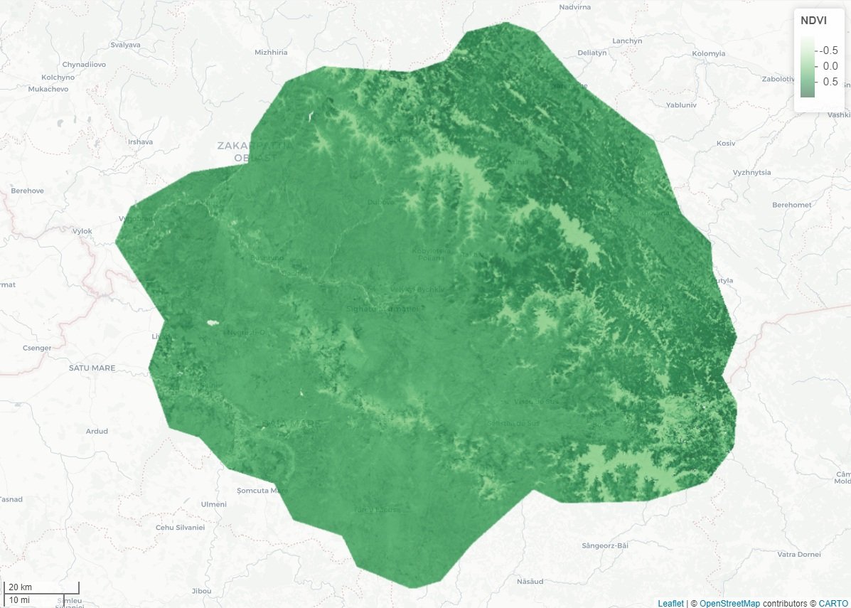
MONITORING ECOSYSTEMS
A tool for automatic monitoring of ecosystems and evaluation of interventions. This will facilitate more continuous and proactive monitoring and alerting, needed to detect and address drivers behind biodiversity decline in an early stage.

DIGITAL TWIN MODELS
The modelled ecological and anthropogenic processes serve as the codified body of knowledge to contextualise and interpret environmental observations.
We will also use them to make data-driven prediction and support scenario simulations, thus building upon the latest state of knowledge to create new knowledge about biodiversity drivers and decline.

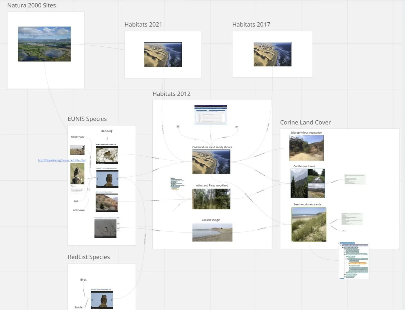
SEMANTICS-DRIVEN DATA METHODS AND TOOLS
These are needed to bridge taxonomic differences between data collections and organisations and prepare the various data sources for the three above-mentioned tools. To this end, we will apply the latest graph and semantic AI technologies.

ECOSYSTEM BASE MAPS
Ecosystem basemaps are automated representations of protected areas that provide information, organised in layers, about all characteristics of the area that can be collected and processed automatically. They thus include biotic, abiotic, natural and anthropogenic features, such as altitudes, gradients, soil types, groundwater levels, surface water, roads, built areas and points of interest, but also calculated layers such moisture and vegetation indexes, lidar-derived vegetation structure, distances to roads, water and built areas, and more.
MONITORING ECOSYSTEMS
We aim for continuous near real-time monitoring of ecosystems to provide actionable information. This is achieved by combining remote sensing images (satellite-based and on-site), with environmental forensics.
We step up from just mapping an area into near real-time monitoring it, and forecasting data. In this way, we get predictive information that can be used to prevent issues before they occur.


DIGITAL TWIN MODELS
The Nature FIRST project makes use of digital twins to create model-driven, continuous ecosystem monitoring beyond simple species counts. A digital twin is essentially a dynamic model of a real-world entity or system that is continuously updated in real-time, to mirror its physical counterpart. These digital twins serve as a means for learning, improving monitoring models, and translating environmental observations into actionable information for site managers and policymakers.
SEMANTIC-DRIVEN DATA METHODS AND TOOLS
Semantic-driven data methods and tools provide a framework for efficient data management and interpretation. These methods establish a unified language through taxonomies, ensuring a shared understanding of concepts. By employing crossovers and exact match relations, diverse data sources are seamlessly integrated into a graph format, facilitating comprehensive analysis and enabling real-time monitoring. This approach not only overcomes challenges in data engineering but also empowers researchers and conservationists to make informed decisions by extracting valuable insights from the interconnected web of information. The multilingual and adaptable nature of these tools, coupled with their ability to incorporate metadata and support cross-domain collaboration, positions them as crucial assets in the proactive and effective management of biodiversity, offering a powerful solution for addressing the complex challenges posed by biodiversity decline.
OUR FIRST AREAS OF APPLICATION
-
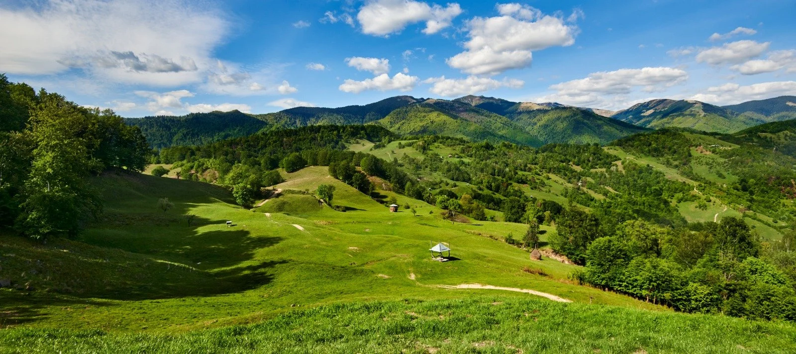
![Scenic landscape with green rolling hills, small huts, and forested areas under a blue sky and scattered clouds, with distant mountains in the background.]()
MARAMURES TRANSBOUNDARY AREA
Continental/Alpine regions - Romania and Ukraine
This field site is located in the Carpathian Mountains, the last region in Europe to support populations of large carnivores such as brown bears, wolves, lynxes and jackals. The main challenges are illegal logging, poaching, infrastructure development.
Credit image: flickr Mihai Lucîț
-
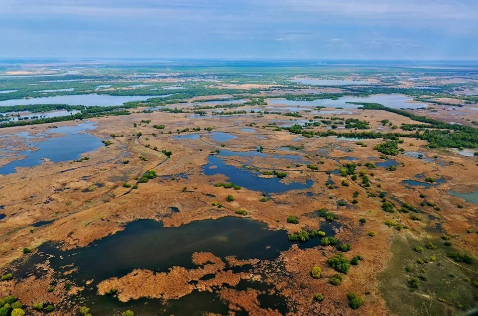
![Aerial view of wetland landscape with patches of water and vegetation.]()
DANUBE DELTA
Steppic and Black Sea regions - Romania
A Natura 2000 site that has original natural features. This field site contains unique river and wetland resources. It is also the habitat and migration corridor for the endangered colonial birds and sturgeon species. The main challenges are poaching, unsustainable tourism.
Credit image: Maria Krommyda (distributed via imaggeo.egu.eu)
-
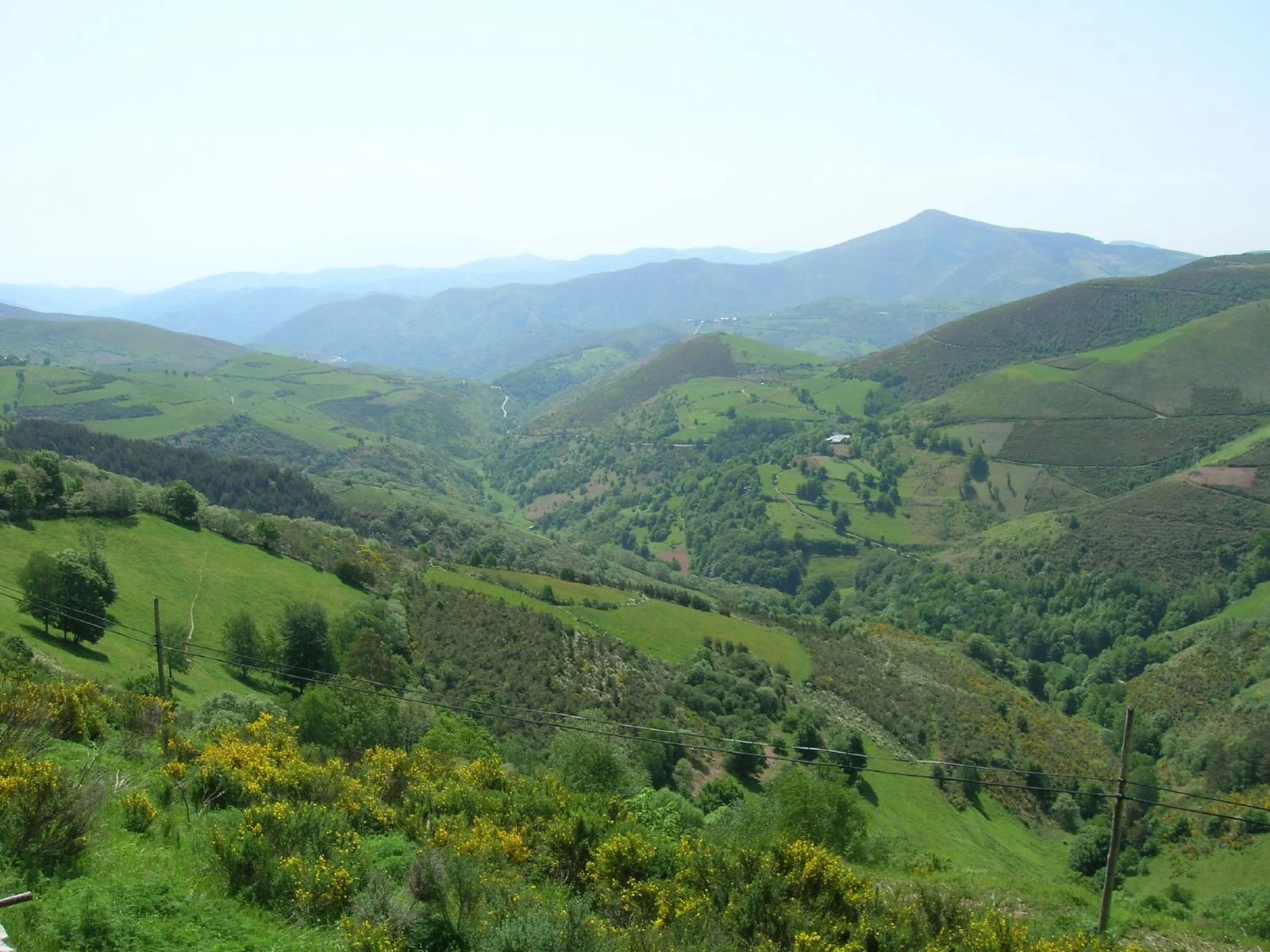
![Panoramic view of lush green hills and valleys with scattered trees and wildflowers, under a clear sky.]()
ANCARES-COUREL
Atlantic/Mediterranean biogeographic regions - Spain
A Natura 2000 site in Northwest Spain, Galicia. This field site has high biodiversity and is inhabited by 150 endangered species. The main challenges are abandonment of farmland, intensification of agriculture, human-wildlife conflicts.
Credit Image: Flickr José Antonio Gil Martínez
-
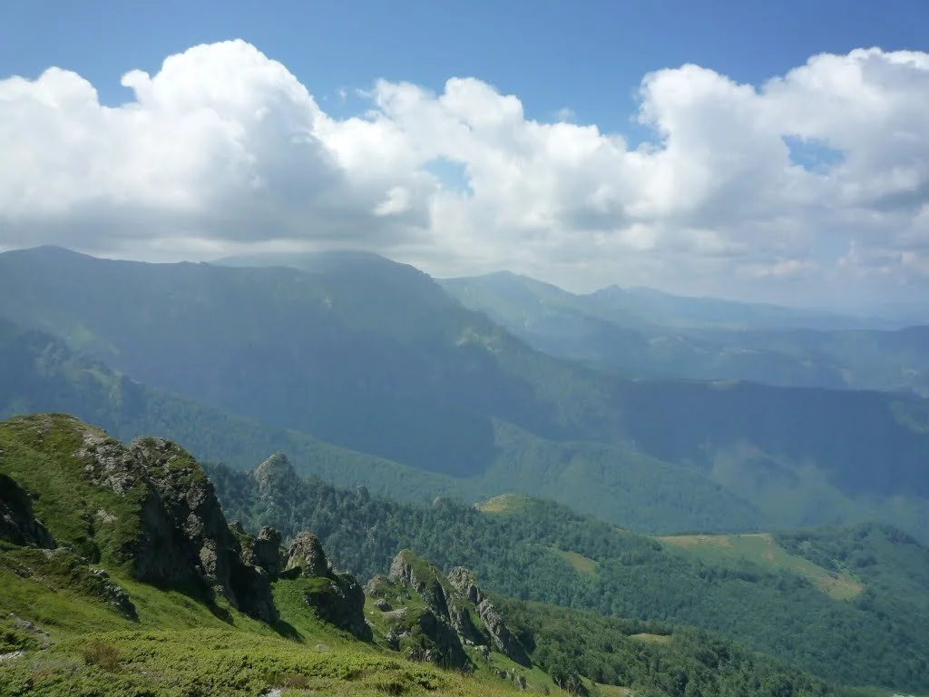
![Mountain landscape with rocky peaks, green vegetation, and a cloudy sky.]()
STARA PLANINA MOUNTAIN
Alpine/Continental regions - Bulgaria
A part of the Central Balkan National Park. This field site falls into three climate zones at the same time. It is inhabited by 80 protected species.
The main challenges are intensification of agriculture, human-wildlife conflicts, poaching.
Credit image: Красимир Косев